
Would you book a place in a neighborhood you haven’t checked first?
Too many travelers do, then face noisy nights, long commutes, or safety headaches.
This guide shows a fast, practical way to judge neighborhood quality before you hit book.
You’ll learn a three-question quick scan, the best online tools to use, and short on-the-ground checks to confirm what the data hides.
Use the defaults I recommend and you can rule out bad choices in under two hours.
No guesswork, just simple steps that save time, money, and stress.
Core Methods to Evaluate a Neighborhood Before Choosing a Place to Stay
Start with a fast scan that answers three questions: Does this area feel safe enough? Can I reach what I need easily? Does it look maintained or falling apart? A quick initial check saves you from wasting hours on neighborhoods that don’t meet basic requirements.
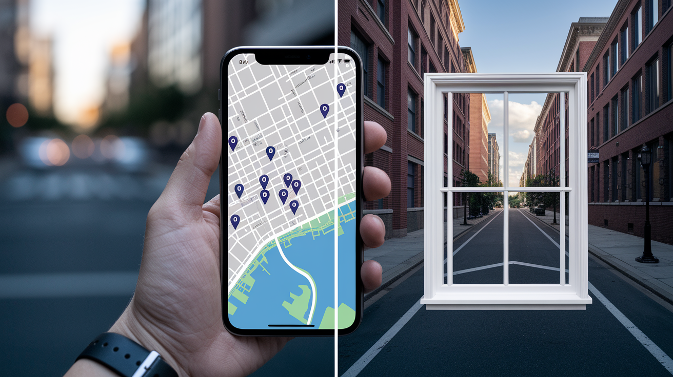
Use virtual tools first, then confirm with short in-person visits. Virtual tools show crime patterns, where things are, and what streets look like without leaving home. In-person visits reveal noise, lighting, and how the area actually feels during the hours you’d be there. Together, these give you a complete picture in under two hours.
Your goal is simple: eliminate bad choices fast and focus on places worth deeper evaluation. A structured scan keeps you efficient and catches obvious problems that only show up at certain times or in specific data sources.
- Skim local crime maps for clusters of violent incidents or property theft within the past year.
- Use Google Street View to “walk” routes from potential addresses to grocery stores, transit stops, and restaurants you’d use regularly.
- Check access to essentials. Confirm a grocery store, pharmacy, and transit stop show up within comfortable walking distance.
- Glance at commute options by mapping door-to-door routes during peak hours using transit or driving apps.
- Scan street cleanliness, building facades, and the condition of sidewalks and parks in Street View.
- Note daytime and nighttime character by checking foot traffic, lighting, and business activity in photos or live webcams if available.
- Read five to ten recent resident reviews or social media posts to catch recurring complaints about noise, safety, or building maintenance.
Safety and Crime Indicators When Assessing a Neighborhood

Safety evaluation needs multiple data points over time, not a single snapshot. Start with crime mapping tools that display recent incidents by category (violent crime, property crime, drug offenses) and look for clusters near your potential address. A neighborhood with occasional isolated incidents is normal. Repeated violent crime reports in the same few blocks are a serious warning.
Compare local crime rates to the city average to understand relative risk. If property theft is 30% higher than citywide, expect break-ins or car theft to be a persistent concern. Visit at different times to observe police presence, visible security like cameras or gated entry, and lighting quality after dark. Well-lit streets with active evening foot traffic usually correlate with lower crime.
Review these five crime indicators before deciding:
- Multi-year violent crime trends (check if incidents are rising, steady, or falling over 12 to 36 months).
- Property crime concentration (look for clusters of theft, burglary, or vandalism within a quarter mile radius).
- Recent police blotter headlines or frequent 911 activity logs in local news.
- Visible security infrastructure (streetlights, cameras, neighborhood watch signs, gated access).
- Resident reports of safety concerns in online reviews or community forums.
How to Compare Crime Trends Accurately
Request or download 12 to 36 month trend charts from local police websites or third-party crime mapping platforms instead of relying on a single week’s data. A neighborhood might show low crime during one snapshot but have rising violent incidents over the past year. That upward trend is a red flag even if current numbers look acceptable. Focus on violent crime clusters (assault, robbery, shootings) more than isolated property crimes. Persistent violent activity signals deeper safety problems that are harder to avoid.
Walkability, Transit Access and Daily Commute Evaluation

Walkability and transit determine whether you’ll need a car for daily errands and how much time you’ll spend commuting. Neighborhoods with high walk scores let you reach grocery stores, cafes, and pharmacies on foot, cutting transportation costs and making daily routines faster. Low walk scores mean you’ll drive or ride-share for nearly every errand, adding expense and reducing spontaneity.
Test your door-to-door commute during peak hours before committing. A route that looks simple on a map can involve long waits, multiple transfers, or unreliable service during rush periods. If your commute exceeds 30 minutes each way or requires more than one transfer, factor that stress into your decision. It compounds quickly over weeks and months.
| Score/Metric | Meaning | Practical Impact |
|---|---|---|
| Walk Score 90–100 | Walker’s Paradise | Daily errands possible without a car; grocery, dining, transit all within 5–10 min walk |
| Walk Score 70–89 | Very Walkable | Most errands on foot; may need a car or ride-share occasionally |
| Walk Score 50–69 | Somewhat Walkable | Some amenities nearby; car required for many tasks |
| Walk Score <50 | Car-Dependent | Almost all errands require driving; expect higher transport costs |
Amenities and Essential Services That Define Neighborhood Livability

A neighborhood without a grocery store, pharmacy, or reliable transit within walking distance forces you to plan every errand as a separate trip. That extra friction adds up fast. Missed meals, delayed medication pickups, wasted time searching for basics. Confirm these essentials are present before you commit.
Look for at least three dining options within a comfortable walk. Restaurants, cafes, and casual takeout spots indicate active street life and give you fallback meal options when you don’t want to cook. Vacant storefronts or a single convenience store as the only food source suggest weak demand and possible safety concerns, especially at night.
Green space access matters for daily mental health and exercise. A park, greenway, or public plaza within half a mile gives you a place to decompress, walk, or meet neighbors. Neighborhoods without accessible green space feel more isolated and offer fewer free activity options.
- Grocery or convenience store within 0.25 to 0.5 miles (roughly a five to ten minute walk).
- Pharmacy or walk-in medical clinic within one mile.
- At least three dining options (restaurants, cafes, or food trucks) within walking distance.
- Reliable public transit route with stops within 0.1 to 0.3 miles (two to six minute walk).
- Park, green space, or public plaza within 0.5 miles.
- Banking or ATM access for cash and in-person service needs.
Understanding Neighborhood Demographics, Schools, and Community Profile

Demographic patterns shape the services, businesses, and long-term stability you’ll experience. Neighborhoods with higher household incomes and education levels typically maintain better infrastructure, attract higher quality retailers, and see stronger property value growth. Areas with large retiree populations may be quieter but offer fewer family-oriented services. Neighborhoods with many young families prioritize schools, playgrounds, and after-school programs.
School quality signals broader neighborhood investment even if you don’t have children. High-performing schools attract stable, engaged residents who vote in local elections, fund parks and libraries, and maintain property values. Check average test scores, college-bound percentages, and spending per student to gauge whether the district is well-funded and improving or struggling financially.
How School Ratings and Demographics Influence Livability
Strong school districts correlate with long-term neighborhood demand because families prioritize education when choosing where to live. That demand keeps property values steady, supports local businesses, and encourages residents to stay longer, reducing turnover and building community cohesion. Even short-term renters benefit. Low turnover means better-maintained buildings, established social networks, and fewer surprise disruptions like sudden rent hikes or building sales.
Property Values, Rental Conditions and Long-Term Stability Signals

Property value trends reveal whether a neighborhood is gaining demand, holding steady, or declining. Steady or rising values over the past three to five years indicate stable or improving conditions. Falling values suggest residents are leaving due to crime, poor services, or economic decline. Compare the neighborhood’s median rent or sale price to the citywide median. Prices more than 25% above the city average signal a premium area with higher costs but often better safety and amenities.
Below median pricing can mean affordability or hidden risk. If prices are significantly lower than surrounding areas, investigate why: is it temporary (new development not yet complete), or structural (high crime, poor transit, declining schools)? Look for signs of positive change like new construction permits, planned transit expansions, or luxury developments nearby that could lift values over time.
- Review three to five year property value or rent price trends using county assessor sites or real estate market trackers.
- Compare local median prices to citywide medians to assess relative cost and demand.
- Check for active building permits and planned developments that signal growth or gentrification.
- Note nearby high-end construction or recent luxury projects. They often boost surrounding property values.
- Track vacancy rates and turnover. High volumes of “for rent” or “for sale” signs suggest instability or declining desirability.
On-the-Ground Checks: Cleanliness, Lighting, Noise, and Daily Conditions

Physical conditions you observe during visits reveal maintenance priorities and resident engagement. Well-maintained facades, clear sidewalks, and functioning streetlights show active property management and city services. Frequent graffiti, overflowing trash bins, and cracked sidewalks indicate neglect and weak enforcement of codes. Boarded windows and vacant lots are immediate red flags. They attract vandalism and signal disinvestment.
Noise levels vary dramatically by time of day. A quiet weekday afternoon can turn into a loud nightlife zone after 10 pm, or morning commuter traffic might bring constant truck noise and honking. Visit during the times you’ll actually be home (evenings, weekends, early mornings) and measure perceived noise against your tolerance. Consistent nighttime noise above normal conversation levels (roughly 60 decibels) disrupts sleep and compounds stress over time.
Assess pedestrian safety by walking the routes you’d use daily. Are crosswalks clearly marked and lit? Do drivers yield to pedestrians, or do you feel rushed and unsafe crossing streets? Missing sidewalks, poor sightlines at intersections, and fast-moving traffic make walking stressful and dangerous, especially for families or anyone with mobility concerns.
What Nighttime Conditions Reveal
Lighting quality and foot traffic change completely after dark. Streets that feel safe and active at 3 pm can become deserted and poorly lit by 9 pm, creating safety concerns and limiting your ability to walk home comfortably. Check whether streetlights work, whether businesses stay open into the evening, and whether you see other pedestrians, dog walkers, or diners on patios. All positive signs of an engaged, safe community after sunset.
Using Online Tools, Maps, and Local Reviews for Neighborhood Research

Digital research tools let you evaluate neighborhoods remotely before spending time on in-person visits. Google Street View provides block level inspection. “Walk” from a potential address to nearby grocery stores, transit stops, and restaurants to simulate daily routes and assess building maintenance, sidewalk condition, and general upkeep. Crime mapping platforms display incident clusters and multi-year trends, helping you spot problem areas and track whether conditions are improving or worsening.
Review platforms and neighborhood social networks surface resident sentiment that official data misses. Read ten to thirty recent reviews across multiple sources and search community forums for recurring complaints. Persistent noise, safety concerns, pest problems, or parking shortages are warning signs. Look for patterns, not isolated complaints. One negative review about a loud neighbor is normal, but ten reviews mentioning nighttime noise suggest a structural problem you’ll face too.
- Google Street View for visual block level inspection and route simulation.
- Crime mapping tools (local police websites or third-party platforms) for incident counts, trends, and cluster analysis.
- Walk Score and Transit Score calculators for walkability and transit access metrics.
- Yelp, Google Reviews, and local business pages for resident comments on safety, service quality, and community vibe.
- Neighborhood Facebook groups, Reddit threads, and Instagram geotags for real-time resident discussions and hidden issues.
- Local news outlets and community blogs for development projects, zoning changes, and upcoming infrastructure work.
Red Flags and Deal-Breakers When Judging a Neighborhood

Some warning signs indicate fundamental problems you can’t easily fix or avoid. Rising violent crime trends over multiple reporting periods signal worsening safety that won’t improve quickly. Multiple boarded buildings, frequent graffiti without cleanup, and visible drug activity during daytime visits point to weak city services and low resident engagement. Conditions that make daily life stressful and unpredictable.
Poor or inconsistent transit connections trap you in longer commutes or force you to own a car, raising costs and reducing flexibility. Lack of nearby essentials (no grocery store or pharmacy within walking distance) means every basic errand becomes a separate trip, draining time and making spontaneous meal planning nearly impossible.
- Persistent violent crime clusters within a quarter mile radius, especially if incidents are rising over 12 to 36 months.
- Multiple boarded or abandoned buildings on the same block, indicating disinvestment and weak code enforcement.
- No functional streetlights or many broken lights, creating unsafe conditions after dark.
- Lack of sidewalks or pedestrian infrastructure, forcing you to walk in traffic or making walking impractical.
- Visible drug use or dealing during daytime visits. If it’s happening openly in daylight, nighttime conditions are worse.
A Quick Evaluation Checklist for Choosing Where to Stay

Complete 30 to 60 minutes of online research first, then schedule at least three in-person visits (one weekday daytime, one weekday evening, and one weekend). The online phase filters out obviously unsuitable neighborhoods. The visits confirm livability and reveal conditions data can’t capture, like noise, lighting quality, and the feel of the area during your actual schedule.
- At least one positive safety metric compared to the city average (lower violent crime rate, falling property crime trend, visible security measures).
- Essential amenities within target distances: grocery within 0.5 miles, transit stop within 0.3 miles, dining options within walking distance.
- Commute time and reliability fit your daily tolerance (typically under 30 minutes door-to-door, fewer than two transfers).
- Walk Score or Transit Score aligns with your car ownership preference and budget.
- Clean, well-maintained streets, sidewalks, and building facades observed during visits.
- Functioning streetlights and comfortable nighttime pedestrian conditions.
- Minimal noise during times you’ll be home (evenings, weekends, early mornings).
- No more than one or two red flag indicators present (e.g., one isolated boarded building is acceptable; multiple on the same block is not).
- Overall scoring using a simple rubric: safety 30%, transit 20%, amenities 20%, walkability 10%, cleanliness 10%, noise 10%. Totals 75 or higher for a strong candidate.
- Resident reviews and social media sentiment show generally positive or neutral experiences, with no recurring complaints about safety, pests, or building management failures.
Final Words
You’re scanning maps, checking safety signals, and mentally timing a walk from transit to a grocery.
This post gave a tight, step-by-step way to evaluate safety, walkability, amenities, schools, market signals, and real-world conditions, plus red flags and a ready checklist you can use fast.
Use the checklist to decide how to evaluate neighborhood when choosing a place to stay: do a 30–60 minute online scan, make three short visits, and give each area a quick score. Do that and you’ll book with confidence.
FAQ
Q: What is the 3-3-3 rule in real estate?
A: The 3-3-3 rule in real estate is a flexible heuristic; commonly it means plan to hold a property about three years, keep three months of cash reserves, and run three quick market checks before deciding.
Q: How would you evaluate your neighborhood?
A: To evaluate your neighborhood, check safety signals, everyday convenience, commute options, cleanliness, and resident feedback; do online scans and at least one in-person visit at different times to confirm impressions.
Q: What devalues a neighborhood and what are the red flags of neighbors?
A: Things that devalue a neighborhood and neighbor red flags include rising crime, boarded or vacant buildings, frequent police activity, persistent graffiti, visible drug use, noisy or hostile neighbors, and missing essential services.