
Choosing a hotel by a glossy photo or a “central” label can quietly ruin your trip.
You don’t have to trade safety for easy transit.
This post lays out a simple, repeatable method to choose a hotel that keeps you safe and saves travel time.
Measure the walk to the nearest stop, check how often buses or trains run, and verify neighborhood safety with crime maps, Street View, and guest reviews.
Use the quick checklist here to pick a spot that won’t force you to choose between convenience and peace of mind.
Key Factors for Choosing a Safe, Transit‑Accessible Hotel Location

Your hotel location shapes your entire trip. Safety, comfort, and how much time you burn getting anywhere all trace back to where you sleep. A hotel that looks close on a map can steal an hour every day if transit’s slow or runs once every half hour. And a “central” address can turn stressful fast when you’re walking poorly lit streets at night. The best choice balances safety with real transit access, not the prettiest circle on a booking site.
Start by checking how far you’ll actually walk to transit and how long you’ll stand around waiting. Most solid choices sit 400 to 800 meters from a station or major stop. That’s about 5 to 10 minutes on foot. Push past 800 meters and you’re walking over 10 minutes, crossing more blocks with fewer safety signals like lighting and open shops. Next, verify how often transit actually runs during the hours you’ll use it. A single route with 30 minute gaps means your average wait is 15 minutes, which can double your total door to door time. If Google shows a 15 minute journey, add half the wait time to get a realistic number. Real example: a Portland hotel showed a 15 minute map radius but turned into a 30 minute average trip because the only bus ran every 30 minutes. Don’t trust circular buffers or tools that pretend wait time doesn’t exist.
Safety takes layering multiple data points. Check crime density within 500 to 1,000 meters of each hotel using police or city crime maps. Look for incident rates below twice the city average, and especially dodge concentrations of violent or nighttime events. Use Google Street View to inspect lighting, active businesses in the evening, and sidewalk quality along the walk to your nearest transit stop. Cross reference recent guest reviews for repeated mentions of “safe walk,” “well lit,” or warning phrases like “sketchy at night.”
Before booking, run this quick checklist:
- Measure walking distance to the nearest transit stop. Aim for 800 meters or less.
- Check transit frequency. Prefer gaps of 15 minutes or less, avoid anything over 30 minutes.
- Overlay a crime map within 500 to 1,000 meters. Confirm low incident density.
- View Street View along the route from hotel to station to verify lighting and foot traffic.
- Read 20 or more recent guest reviews, filtering for safety and transit keywords.
- Confirm night service availability if you’ll return late. Note last train or bus times.
When all three factors align (short, safe walk; frequent, reliable transit; verifiable low crime), you’ve found a hotel zone that won’t force you to choose between convenience and peace of mind. This combined method prevents the common mistake of trusting a map blob that shows reach without showing risk or wait time.
Evaluating Neighborhood Safety Around Potential Hotel Locations

Personal safety around your hotel depends on visible activity, infrastructure, and incident history. Not the hotel’s star rating or marketing photos. Begin with official crime maps that show the past 12 months of incidents within a 500 to 1,000 meter radius of each candidate hotel. Many cities publish open police data, and aggregator sites or local Reddit threads often link to current neighborhood crime reports. Look for total incident counts per 1,000 residents and the split between property and violent crime. If violent crime exceeds 10 incidents per 1,000 residents annually or runs more than double the city average, treat that zone as higher risk. Cross check incident timing. Concentrations of nighttime events matter more if you’ll walk after dark.
Next, use Google Street View to walk the route from the hotel entrance to the nearest transit stop at multiple times of day. Visible street lighting, open cafes or shops in the evening, wide sidewalks, and steady foot traffic are strong safety signals. Compare daytime and evening conditions if the service offers historical imagery. Supplement Street View with traveler reviews that explicitly mention safety. Trust clusters of at least 20 recent reviews using phrases like “felt safe walking at night” or “well lit streets.” Ignore single outlier comments, but repeated warnings such as “avoid after dark,” “dark alleys,” or “sketchy blocks” are red flags you shouldn’t dismiss.
Red flags to avoid when reviewing neighborhoods:
- High concentration of incidents within 500 meters, especially violent or nighttime crime.
- Streets lacking visible lighting or showing vacant storefronts on Street View.
- Isolated blocks with minimal foot traffic even during peak hours.
- Multiple recent guest reviews repeating safety warnings or mentioning uncomfortable walks.
- Lack of emergency services (police station, hospital, 24 hour pharmacy) within 1 kilometer.
Measuring Transit Access When Selecting a Hotel
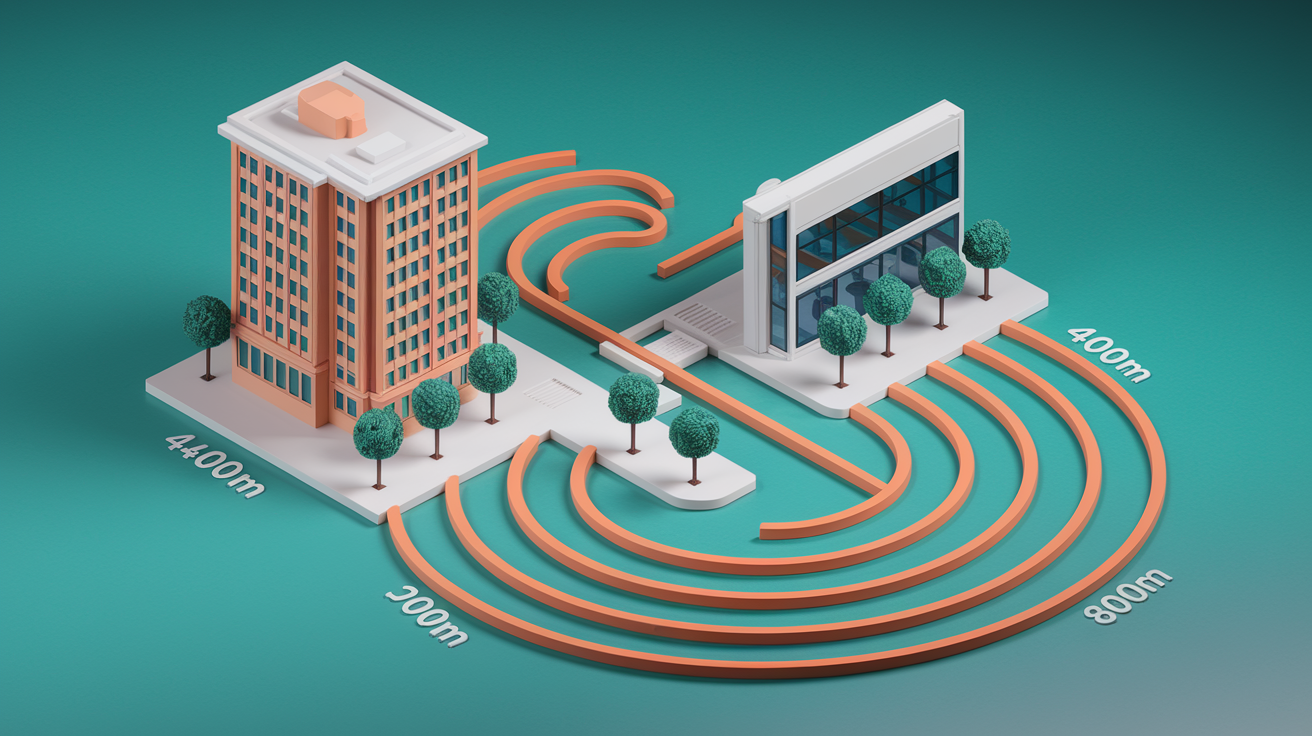
Transit convenience starts with walking distance but depends on frequency, operating hours, and route coverage. The ideal hotel sits 400 to 800 meters from a station or major stop, translating to a 5 to 10 minute walk. Within 400 meters (roughly 5 minutes), you gain the easiest daily access and safer night arrivals. Beyond 800 meters, your walk stretches past 10 minutes, and you add exposure to weather, fatigue with luggage, and potential safety gaps on longer routes. Measure distance using mapping tools along actual pedestrian paths, not straight line radius, because buildings and barriers often force detours.
Frequency matters as much as distance. A stop 10 minutes away with trains every 5 minutes beats a stop 5 minutes away served by a bus every 30 minutes. Use the rule that average wait equals half the scheduled gap. If a route runs every 20 minutes, expect to wait 10 minutes on average, which turns a 10 minute ride into a 20 minute typical journey. Before booking, check timetables at your expected travel times (weekday mornings, evenings, and weekends) to confirm service patterns. Many hotel finders show transit coverage without displaying frequency, leading to choices that look connected but feel slow in practice. Always verify the actual schedule, not just the presence of a line on a map.
Night service and route redundancy are your safety nets. Confirm the last train or bus departs after your latest expected return, and check whether alternative lines serve the same hotel within walking distance. A hotel near a single infrequent route becomes a problem if you miss the last service or a line closes for maintenance. Multiple lines within a 10 minute walk offer flexibility and reduce the risk of being stranded.
| Transit Metric | Recommended Target |
|---|---|
| Walking distance to nearest stop | 400 to 800 meters (5 to 10 minutes) |
| Transit frequency during travel hours | 15 minute gaps or less (frequent); accept 15 to 30 minutes with caution; avoid over 30 minutes |
| Night service availability | Last service departs 1 hour or more after your latest expected return |
| Number of independent lines within walking distance | 2 or more lines for redundancy and flexibility |
Cross‑Referencing Safety Data With Transit Convenience

The strongest hotel locations combine low crime density with short, frequent transit access, but you have to layer the data yourself because booking sites rarely integrate both. Start by mapping candidate hotels on a transit route overlay, then open a crime map or police data layer in the same view. Filter for incidents within 500 to 1,000 meters of each hotel address over the past 12 months. If a high crime zone surrounds your closest transit stop, consider hotels one or two stops farther along the line in a safer neighborhood, even if that adds 5 to 10 minutes to your transit ride. A slightly longer ride on a safe route beats a short walk through a high incident area.
After identifying lower crime blocks near transit, verify walkability and lighting. Check Walk Score for each candidate. Aim for a score of 70 or higher to ensure pedestrian infrastructure exists. Use Street View to confirm the path from hotel to station includes sidewalks, crosswalks, and visible lighting. If the station itself sits in a well connected area but the hotel approach crosses isolated or unlit streets, downgrade that choice regardless of transit frequency. The last few hundred meters of your walk carry the most risk when you’re tired, carrying bags, or arriving after dark.
Here’s a five step process to cross compare data:
- Map your shortlist of hotels and identify all transit stops within 800 meters of each.
- Check scheduled gaps at your expected travel times. Calculate average wait as half the gap.
- Overlay a crime map within a 500 to 1,000 meter radius of each hotel. Note incident density and timing.
- Verify Walk Score of 70 or higher and inspect Street View for lighting and sidewalk quality along the hotel to station route.
- Read at least 20 recent guest reviews filtering for “safety,” “walk,” “station,” and “night” to confirm real traveler experience.
This layered method prevents booking a hotel that’s either close but unsafe, or safe but so far from transit that your daily travel time doubles. When both metrics align, you’ve found a location that supports efficient sightseeing and confident late arrivals.
Identifying Red Flags in Hotel Locations Related to Safety and Transit

Certain location patterns reliably predict frustration or risk. Hotels marketed as “near station” but requiring more than 1,200 meters (roughly a 15 minute walk) to reach transit are misleading. That distance feels manageable on a booking map but becomes a burden with luggage, in rain, or after a long travel day. Similarly, avoid areas served by a single transit route with gaps longer than 30 minutes. When only one line reaches the hotel and it runs infrequently, a missed connection or service disruption leaves you stranded or forces expensive taxi rides.
Lighting and crime concentration are immediate deal breakers. If Street View shows the path from hotel to station lacks visible streetlights or passes vacant lots, industrial zones, or deserted residential blocks, skip that choice. Check crime maps for tight clusters of incidents within a few blocks of the hotel address. A single high density hotspot nearby raises your exposure every time you leave or return. Also distrust booking tools that display large circular buffers or colored blobs suggesting broad transit reach without showing actual routes or schedules. These visualizations often ignore wait time and walking networks, making distant or poorly connected hotels appear accessible.
Location red flags to avoid:
- Walking distance to nearest transit stop exceeds 1,200 meters (over 15 minutes).
- Only one transit route serves the area, and it runs with gaps over 30 minutes.
- Street View reveals unlit streets, abandoned storefronts, or isolated paths between hotel and station.
- Crime map shows concentrated incident clusters within 500 meters of the hotel.
- Booking map uses a circular buffer or isochrone that doesn’t account for scheduled frequency or network walking paths.
- Multiple recent guest reviews mention safety concerns, long waits, or difficulty reaching transit.
Using Tools to Analyze Hotel Surroundings and Transit Quality

Effective research combines mapping, walkability scores, official schedules, and ground level verification. Start with Walk Score and Transit Score to get baseline metrics. Walk Score measures pedestrian infrastructure and nearby amenities. Aim for 70 or higher. Transit Score evaluates stop density and service frequency. Target 60 or above for convenient daily access. These scores give you a quick filter but don’t reveal crime or lighting, so treat them as a starting point, not a final answer.
Next, use official transit agency maps and timetables, ideally those published in GTFS format or on the agency’s trip planner. GTFS feeds power many apps and show real scheduled frequencies, not idealized travel times. Confirm gaps at the times you’ll actually travel (early morning, evening rush, late night, and weekends) because service often drops sharply outside peak hours. Many general mapping tools display transit routes but assume zero wait time, which can halve the realistic coverage area. Prefer tools that build network based isochrones from actual schedules over those drawing circular buffers around stops.
Google Street View remains the best free option for visual verification. Walk the route from the hotel entrance to the nearest station at both daytime and evening (if historical imagery is available). Check for sidewalks, crosswalks, lighting fixtures, and active ground floor businesses. Supplement Street View with local crime maps or police open data portals. Most large cities publish incident locations and types. Filter for the past 12 months and focus on violent or nighttime crime within 500 to 1,000 meters of your hotel. Finally, scan recent traveler reviews on hotel booking sites and travel forums, filtering for keywords like “safe,” “walk,” “station,” “night,” and “lighting.” Patterns across 20 or more reviews are more reliable than single anecdotes.
For deeper context, consult resources like Hotel Location: Safety & Transit Guide, which offers structured checklists and examples of researching hotel surroundings using these combined data sources.
Key tool categories to use:
- Walkability and transit scoring services (Walk Score, Transit Score) for baseline metrics.
- Official transit agency timetables and GTFS based trip planners for accurate frequency and service hours.
- Google Street View for visual inspection of lighting, sidewalks, and street activity.
- Local crime maps and police open data portals for incident density and timing within 500 to 1,000 meters.
Comparing Example Neighborhoods to Understand Safety and Transit Balance

Real city examples show how these principles work in practice. In San Francisco, Union Square sits at the center of multiple BART and Muni lines with gaps under 10 minutes during most hours. The area is well lit, patrolled, and crowded with tourists and locals until late evening, offering both safety through visibility and fast transit connections. Fisherman’s Wharf and the Financial District share similar transit density and maintained infrastructure, though Fisherman’s Wharf can feel isolated after tourist hours, and the Financial District empties on weekends. For quieter, still safe options, Nob Hill, Pacific Heights, and the Marina District offer lower crime rates and steady residential foot traffic but require slightly longer walks to frequent transit, typically 10 to 15 minutes to a major Muni or cable car stop.
New York City’s Midtown Manhattan remains the gold standard for combined safety and transit access. Hotels within a few blocks of Times Square, Penn Station, or Grand Central Terminal sit within 5 minutes of multiple subway lines with 24 hour service and sub 10 minute frequencies. SoHo, Greenwich Village, and the East Side (Murray Hill, Gramercy) also deliver strong safety metrics and dense subway coverage, though late night service on some lines drops to 15 to 20 minute gaps. Brooklyn’s Williamsburg and Queens’ Long Island City have improved safety profiles and offer direct subway access to Manhattan in 10 to 15 minutes, making them viable if Manhattan hotel prices stretch your budget. Both neighborhoods show active evening street life and well lit main corridors, though side streets can be darker and quieter.
These examples highlight a consistent pattern. Central tourist or business districts maximize both safety through maintained infrastructure and transit through network density, while quieter residential neighborhoods trade some transit frequency for lower crime and more personal space. The right choice depends on your daily destinations, arrival times, and comfort walking 10 to 15 minutes versus 5 minutes to a station.
| Neighborhood | Safety Traits | Transit Traits |
|---|---|---|
| San Francisco Union Square | High foot traffic, well lit, visible police presence; busy until late evening | Multiple BART and Muni lines; 10 minute gaps or less most hours; 24 hour service on some routes |
| NYC Midtown Manhattan | Constant pedestrian activity, maintained streets, monitored public areas; active 24/7 | Dense subway network; 10 minute gaps or less on most lines; true 24 hour service |
| Brooklyn Williamsburg | Active evening street life on main corridors, lower overall crime than Manhattan; side streets quieter | Direct L and G subway access; 10 to 15 minute ride to Manhattan; evening gaps 10 to 15 minutes |
Practical Booking Checklist for Safe, Transit‑Optimized Hotel Selection
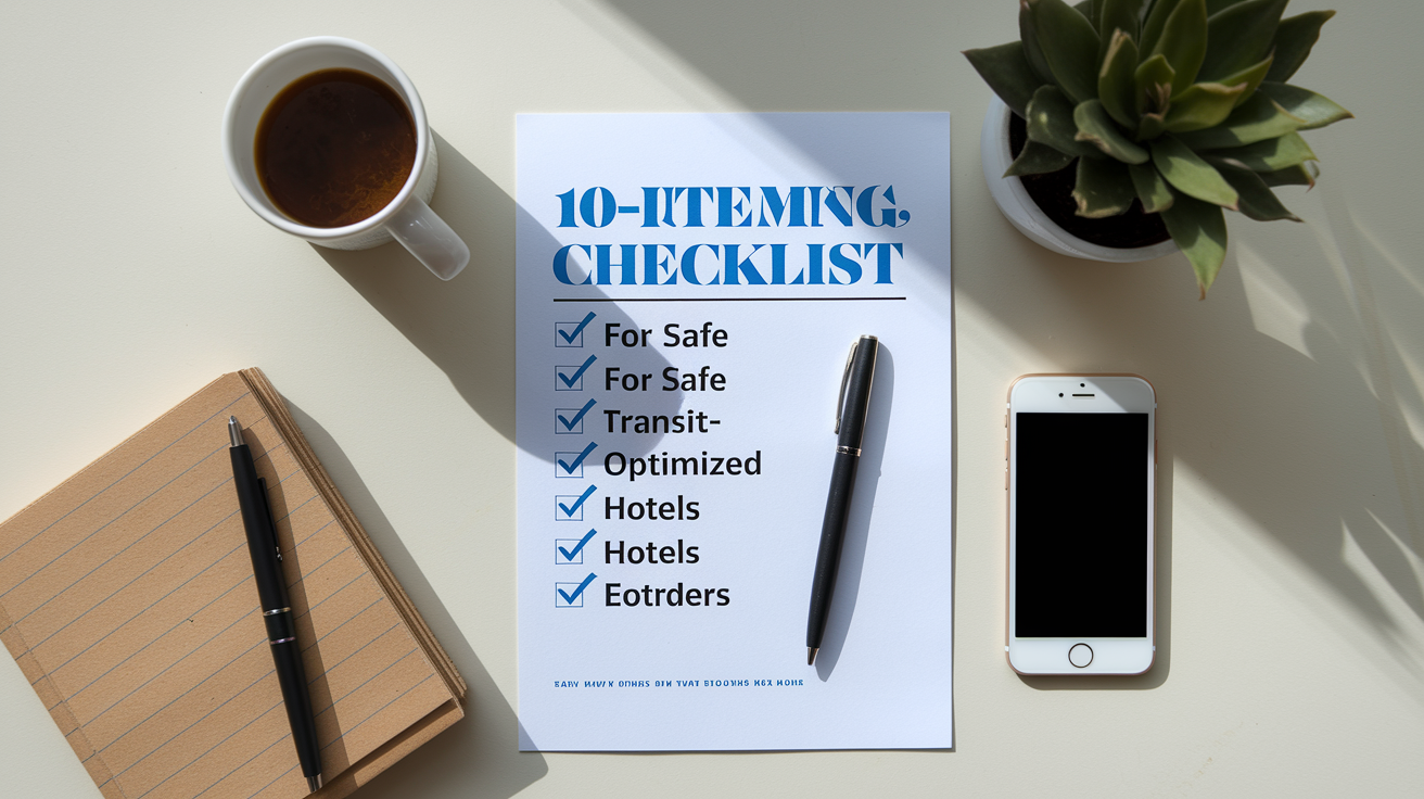
Before you confirm a reservation, run through a compact field checklist that verifies both safety and transit access. This list catches the gaps that booking sites and promotional photos hide. Print it or save it on your phone, and complete every item for each candidate hotel before comparing final options.
Use this 10 item checklist to confirm your hotel choice:
- Measure walking distance to the nearest transit stop. Confirm 800 meters or less (10 minutes or less).
- Check transit gaps at your expected travel times (morning, evening, weekend). Prefer 15 minutes or less.
- Verify last train or bus departs at least one hour after your latest expected return.
- Overlay a crime map within 500 to 1,000 meters. Confirm incident density is below twice the city average.
- Use Google Street View to inspect lighting, sidewalks, and street activity along the hotel to station route.
- Read at least 20 recent guest reviews, filtering for “safe,” “walk,” “station,” “night,” and “lighting.”
- Confirm the hotel offers 24/7 staffed reception or secure entry for late arrivals.
- Check Walk Score of 70 or higher and Transit Score of 60 or higher for baseline walkability and transit convenience.
- Verify at least two independent transit lines serve the area within a 10 minute walk for redundancy.
- Identify the nearest emergency services (police station, hospital, 24 hour pharmacy) within 1 kilometer.
Choose the block that gives you both quick transit and clear safety signals: a 5–10 minute (400–800 m) walk to stops, visible foot traffic, good street lighting, and a clean crime map within 500–1,000 m.
Use the practical rules and tools we covered: measure distance, check headways (≤15 minutes is best), confirm night service and last-train times, and run a door-to-door calc (walk + wait + ride). The checklist helps you compare options fast.
Follow these steps on how to pick a hotel location for safety and transit access and you’ll book a convenient, calm base that makes travel easier.
FAQ
Q: How to determine if a hotel is in a safe area?
A: To determine if a hotel is in a safe area, check crime maps within 500-1,000 m, use Street View for lighting and foot traffic, confirm Walk Score and 20+ recent safety mentions, and verify transit proximity (400-800 m).
Q: Why not stay on the first floor of a hotel?
A: You shouldn’t stay on the first floor because it’s easier for break-ins, louder from street noise, and has less privacy; pick the 2nd-4th floors, request an interior-corridor room, and use the deadbolt.
Q: What is the most stolen item in hotels?
A: The most stolen item in hotels is small electronics like smartphones, chargers, and tablets since they’re easy to grab; keep valuables in the in-room safe, your carry-on, or a lockable bag.
Q: What is the washcloth trick in hotels?
A: The washcloth trick in hotels is placing a towel under the door to detect entry or block light and noise; it’s unreliable—use the deadbolt, a portable door lock, or notify reception for privacy.